
1951 Map of Murdo 3 NE
USGS Topo · Published 1953About this map
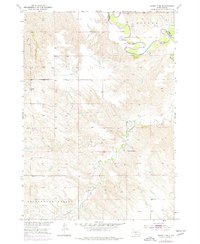
The White River carves a winding path across the northern reaches of this landscape, marking the natural boundary between Mellette and Jones counties. Situated in the early 1950s, this area is defined by its deep drainage patterns and the broad Cottonwood Valley to the south. The terrain is characterized by the intricate dissected uplands of Mullen, where numerous draws and ridges feed into Cottonwood Creek and other unnamed tributaries.
Find a feature on this map
7 named features on this map. Tap any name to fly to it.
Don’t see what you’re looking for? This feature index may not catch every label — zoom into the map to look around manually.
Map Details
Editions of this 1951 Murdo 3 NE Map
3 editions found
Other maps of this area

1951 · Okaton SW
USGS Topo · 1:24,000

1951 · Westover
USGS Topo · 1:24,000

1951 · Murdo SW
USGS Topo · 1:24,000

1951 · Murdo 3 NW
USGS Topo · 1:24,000

1951 · Okaton SE
USGS Topo · 1:24,000

1955 · Martin
USGS Topo · 1:250,000

1958 · Martin
USGS Topo · 1:250,000
1982 · Murdo 3 NW
USGS Topo · 1:25,000

1982 · White River East
USGS Topo · 1:24,000
1982 · White River West
USGS Topo · 1:24,000