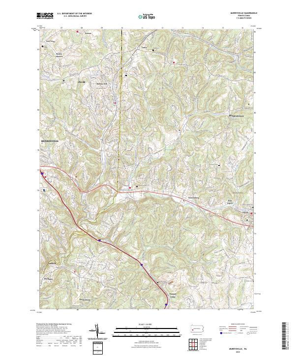
2023 Map of Murrysville
USGS Topo · Published 2023About this map
Murrysville and its neighboring boroughs are defined by a complex network of suburban corridors and older rural clusters along the boundary of Allegheny Co and Westmoreland Co. The landscape is a mix of established residential developments like Holiday Park and historic settlements such as Sardis, Export, and Newlonsburg. This 2023 survey documents the modern layout of the region, where legacy roads like Old William Penn Hwy and Saltsburg Rd continue to anchor the local geography. Numerous small burial grounds are preserved throughout the area, including Emmanuel Cem and Seceders Lutheran Cem, reflecting the early pioneer and religious foundations of these townships. Water features such as Turtle Creek and Abers Creek wind through the hills, while larger water bodies like Collins Lake and Exton Lake serve as local landmarks amidst the residential growth in Plum and Monroeville.
Find a feature on this map
124 named features on this map. Tap any name to fly to it.
Don’t see what you’re looking for? This feature index may not catch every label — zoom into the map to look around manually.
Map Details
Editions of this 2023 Murrysville Map
This is the sole edition of this map. No revisions or reprints were ever made.
Other maps of this area

1904 · Mc Keesport
USGS Topo · 1:62,500

1904 · Greensburg
USGS Topo · 1:62,500

1906 · Greensburg
USGS Topo · 1:62,500

1907 · Pittsburg
USGS Topo · 1:62,500

1907 · Freeport
USGS Topo · 1:62,500

1908 · New Kensington
USGS Topo · 1:62,500

1909 · Freeport
USGS Topo · 1:62,500

1910 · New Kensington
USGS Topo · 1:62,500

1953 · Pittsburgh
USGS Topo · 1:250,000
1953 · Mc Keesport
USGS Topo · 1:24,000