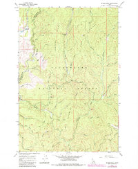
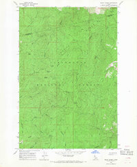
1966 Map of Musselshell
USGS Topo · Published 1984About this map
Musselshell and the adjacent Work Center serve as the primary human outposts in this heavily forested landscape within the Clearwater National Forest. This 1966 survey, updated with 1984 revisions, captures a network of forestry trails and pack paths including the Trail No. 19 and Austin-Eldorado Trail which traverse the drainages of Musselshell Creek and Lolo Creek. Local-history researchers will find the precise location of the Lewis and Clark Grove and the Clark Tree, marking a significant historical corridor through the timberlands. The map reveals the intricate drainage patterns of dozens of mountain streams like Eldorado Creek and Chamook Creek as they cut through Chamook Ridge and the Eldorado Ridge.
Find a feature on this map
2 named features on this map. Tap any name to fly to it.
Don’t see what you’re looking for? This feature index may not catch every label — zoom into the map to look around manually.
Map Details
Editions of this 1966 Musselshell Map
2 editions found
Other maps of this area

1924 · Weippe
USGS Topo · 1:125,000

1956 · Hamilton
USGS Topo · 1:250,000

1959 · Hamilton
USGS Topo · 1:250,000

1960 · Hamilton
USGS Topo · 1:250,000

1964 · Hamilton
USGS Topo · 1:250,000

1966 · Pierce
USGS Topo · 1:24,000
1966 · Glenwood
USGS Topo · 1:24,000
1966 · Hemlock Butte
USGS Topo · 1:24,000

1966 · Lowell
USGS Topo · 1:24,000
1966 · Snowy Summit
USGS Topo · 1:24,000