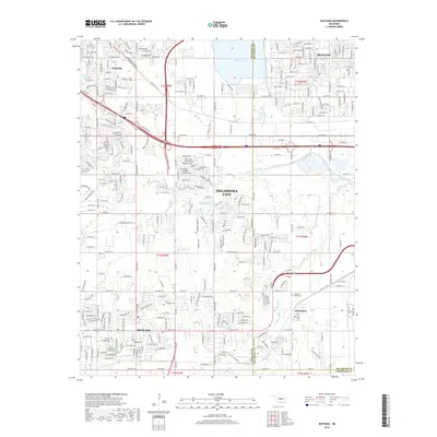
2018 Map of Mustang
USGS Topo · Published 2018About this map
Mustang and Wheatland anchor this 2018 topographic survey, which documents the rapid development where Canadian, Oklahoma, and Cleveland counties meet. The landscape is defined by the hydrologic network of Mustang Creek and the North Canadian River, with the large reservoir of Lake Overholser dominating the northeastern quadrant near Bethany. Modern infrastructure, including the S John Kilpatrick Tpke and S Ranchwood Blvd, cuts through a grid of residential streets and older rural properties. For local history, the map provides precise locations for the Mustang Cem and Pleasant Valley Cem, serving as critical reference points for genealogical research in this suburban corridor between Yukon and Oklahoma City. Minor watercourses like Campbell Cr and Cow Cr remain visible among the expanding road networks of the 21st century.
Find a feature on this map
29 named features on this map. Tap any name to fly to it.
Don’t see what you’re looking for? This feature index may not catch every label — zoom into the map to look around manually.
Map Details
Editions of this 2018 Mustang Map
This is the sole edition of this map. No revisions or reprints were ever made.
Other maps of this area

1892 · Kingfisher
USGS Topo · 1:125,000

1893 · Oklahoma City
USGS Topo · 1:62,500

1893 · Minco
USGS Topo · 1:62,500

1895 · Kingfisher
USGS Topo · 1:125,000

1904 · Chickasha
USGS Topo · 1:125,000

1951 · Britton
USGS Topo · 1:24,000

1954 · Oklahoma City
USGS Topo · 1:250,000

1956 · Oklahoma City
USGS Topo · 1:24,000

1956 · Oklahoma City
USGS Topo · 1:62,500

1956 · Oklahoma City SE
USGS Topo · 1:24,000