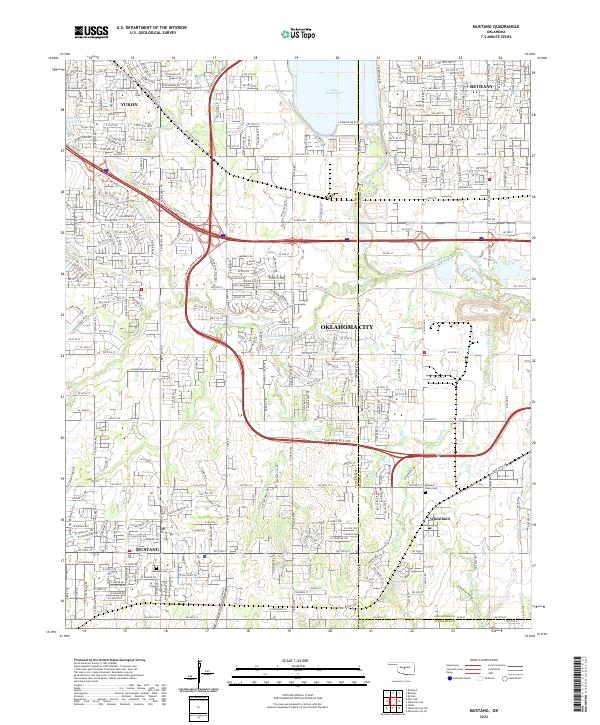
2022 Map of Mustang
USGS Topo · Published 2022About this map
Mustang and the surrounding Canadian County landscape are defined by a mix of suburban expansion and persistent rural landmarks. The S John Kilpatrick Tpke arcs through the center of the sheet, illustrating the modern transportation network that connects Yukon and Bethany to the larger Oklahoma City metropolitan area. Despite the growth of residential subdivisions, traditional community focal points like the Mustang Cem and Pleasant Valley Cem remain as physical links to the area's earlier settlement history.
Find a feature on this map
22 named features on this map. Tap any name to fly to it.
Don’t see what you’re looking for? This feature index may not catch every label — zoom into the map to look around manually.
Map Details
Editions of this 2022 Mustang Map
This is the sole edition of this map. No revisions or reprints were ever made.
Other maps of this area

1892 · Kingfisher
USGS Topo · 1:125,000

1893 · Oklahoma City
USGS Topo · 1:62,500

1893 · Minco
USGS Topo · 1:62,500

1895 · Kingfisher
USGS Topo · 1:125,000

1904 · Chickasha
USGS Topo · 1:125,000

1951 · Britton
USGS Topo · 1:24,000

1954 · Oklahoma City
USGS Topo · 1:250,000

1956 · Oklahoma City
USGS Topo · 1:24,000

1956 · Oklahoma City
USGS Topo · 1:62,500

1956 · Oklahoma City SE
USGS Topo · 1:24,000