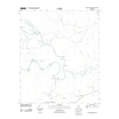
2011 Map of Myrtlewood North
USGS Topo · Published 2011About this map
The Tombigbee River snakes through this portion of Marengo County, defining a landscape shaped by river navigation and rural settlement. Along its winding course, numerous historic river features such as Remberts Landing, Lewis Lower Landing, and Robertson Landing indicate the importance of the waterway for local commerce and transport. The riverbanks are dotted with named sandbars and shoals, including Miles Shoal and Beckleys Bar, which remain significant landmarks for river pilots and local historians tracing the evolution of Alabama's river trade.
Find a feature on this map
46 named features on this map. Tap any name to fly to it.
Don’t see what you’re looking for? This feature index may not catch every label — zoom into the map to look around manually.
Map Details
Editions of this 2011 Myrtlewood North Map
This is the sole edition of this map. No revisions or reprints were ever made.
Other maps of this area

1953 · Montgomery
USGS Topo · 1:250,000

1953 · Meridian
USGS Topo · 1:250,000

1956 · Montgomery
USGS Topo · 1:250,000

1957 · Meridian
USGS Topo · 1:250,000

1957 · Montgomery
USGS Topo · 1:250,000

1965 · Meridian
USGS Topo · 1:250,000

1970 · Myrtlewood North
USGS Topo · 1:24,000
1970 · Jefferson
USGS Topo · 1:24,000

1970 · Old Spring Hill
USGS Topo · 1:24,000

1970 · Linden
USGS Topo · 1:24,000