
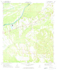
1970 Map of Myrtlewood North
USGS Topo · Published 1973About this map
The Tombigbee River carves a deep, winding path through this corner of western Alabama, defining the boundaries where Sumter, Choctaw, and Marengo counties meet. Along the southern edge, the settlement of Myrtlewood serves as a hub for the Louisville and Nashville railroad, which cuts through the lower portion of the map. The landscape is heavily defined by its water systems, including the complex meanders of Chickasaw Bogue and various wetlands like Dustin Slough.
Find a feature on this map
24 named features on this map. Tap any name to fly to it.
Don’t see what you’re looking for? This feature index may not catch every label — zoom into the map to look around manually.
Map Details
Editions of this 1970 Myrtlewood North Map
This is the sole edition of this map. No revisions or reprints were ever made.
Other maps of this area

1953 · Montgomery
USGS Topo · 1:250,000

1953 · Meridian
USGS Topo · 1:250,000

1956 · Montgomery
USGS Topo · 1:250,000

1957 · Meridian
USGS Topo · 1:250,000

1957 · Montgomery
USGS Topo · 1:250,000

1965 · Meridian
USGS Topo · 1:250,000
1970 · Jefferson
USGS Topo · 1:24,000

1970 · Old Spring Hill
USGS Topo · 1:24,000

1970 · Linden
USGS Topo · 1:24,000

1971 · Whitfield
USGS Topo · 1:24,000