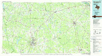
1986 Map of Nacogdoches
USGS Topo · Published 1986About this map
Nacogdoches serves as the central hub of this East Texas study, situated amidst a landscape of dense pine forests and winding bayous in the mid-1980s. The map illustrates a mature regional infrastructure, where the Southern Pacific and Atchison Topeka and Santa Fe railroads thread through timberlands between the Angelina River and the Sabine River. To the east, the vast waters of the Toledo Bend Reservoir dominate the borderlands, while the Angelina National Forest and Sabine National Forest preserve the natural character of the region. Local genealogy is well-represented through numerous rural landmarks, including the cluster of Sulphur Springs Ch, Sulphur Springs Sch, and Sulphur Springs Cem. These legacy sites, alongside smaller settlements like Martinsville, Chireno, and Appleby, reveal the distributed community patterns that defined the Piney Woods before further modern expansion.
Find a feature on this map
198 named features on this map. Tap any name to fly to it.
Don’t see what you’re looking for? This feature index may not catch every label — zoom into the map to look around manually.
Map Details
Editions of this 1986 Nacogdoches Map
This is the sole edition of this map. No revisions or reprints were ever made.
Other maps of this area

1935 · Henderson
USGS Topo · 1:48,000

1937 · Troupe
USGS Topo · 1:48,000

1939 · Henderson
USGS Topo · 1:62,500

1943 · Troup
USGS Topo · 1:62,500

1943 · Cushing
USGS Topo · 1:62,500

1943 · Rusk
USGS Topo · 1:62,500

1944 · Logansport
USGS Topo · 1:62,500

1944 · Patroon
USGS Topo · 1:62,500

1945 · Cushing
USGS Topo · 1:62,500

1945 · Grand Cane
USGS Topo · 1:62,500