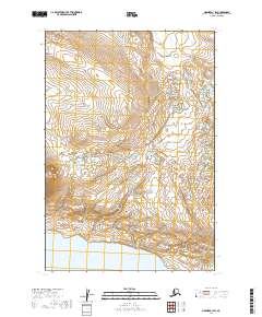
2019 Map of Naknek A-1 SW
USGS Topo · Published 2019About this map
Becharof Lake defines the southern edge of this landscape in the Lake and Peninsula Borough. The terrain is characterized by the prominent elevation of Whale Mtn, surrounded by a complex network of glacial ponds and small drainage basins. This 2019 data release from the U.S. Geological Survey illustrates the topographical detail of the Alaska Peninsula, showcasing the transition from high mountainous peaks to the shoreline of one of the state's largest freshwater bodies. The map is primarily an environmental study of landforms and water systems, including the township boundaries for t24s r43w, t24s r42w, t25s r43w, and t25s r42w. For those researching the remote geography of the region, it provides a precise view of the hydrology and contour intervals that define this unpopulated wilderness area north of the lake.
Find a feature on this map
6 named features on this map. Tap any name to fly to it.
Don’t see what you’re looking for? This feature index may not catch every label — zoom into the map to look around manually.
Map Details
Editions of this 2019 Naknek A-1 SW Map
This is the sole edition of this map. No revisions or reprints were ever made.
Other maps of this area

1943 · Ugashik
USGS Topo · 1:250,000

1948 · Ugashik
USGS Topo · 1:250,000

1949 · Ugashik
USGS Topo · 1:250,000

1951 · Ugashik D-1
USGS Topo · 1:63,360

1951 · Naknek A-2
USGS Topo · 1:63,360

1951 · Naknek A-1
USGS Topo · 1:63,360

1951 · Ugashik D-2
USGS Topo · 1:63,360

1952 · Naknek
USGS Topo · 1:250,000

1963 · Ugashik
USGS Topo · 1:250,000

1964 · Naknek
USGS Topo · 1:250,000