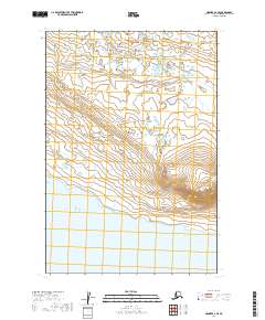
2019 Map of Naknek A-2 SE
USGS Topo · Published 2019About this map
Becharof Lake defines the southern extent of this landscape in the Alaska Peninsula, where the waters meet a coastline marked by subtle topographic shifts. This 2019 survey captures the transition from the low-lying lacustrine environment to the rising elevations of the southeast. The most prominent landform is Whale Mtn, which anchors the southeastern corner of the quadrangle. The map details a complex network of internal drainage and small water bodies that characterize this region north of the lake. These features are documented within the township and range divisions of t24s r44w, t24s r43w, t25s r44w, and t25s r43w. While no major roads or settlements are recorded, the map provides a precise record of the natural terrain and hydrologic patterns essential for understanding the geography of the Lake and Peninsula Borough.
Find a feature on this map
6 named features on this map. Tap any name to fly to it.
Don’t see what you’re looking for? This feature index may not catch every label — zoom into the map to look around manually.
Map Details
Editions of this 2019 Naknek A-2 SE Map
This is the sole edition of this map. No revisions or reprints were ever made.
Other maps of this area

1943 · Ugashik
USGS Topo · 1:250,000

1948 · Ugashik
USGS Topo · 1:250,000

1949 · Ugashik
USGS Topo · 1:250,000

1951 · Ugashik D-1
USGS Topo · 1:63,360

1951 · Naknek A-2
USGS Topo · 1:63,360

1951 · Naknek A-1
USGS Topo · 1:63,360

1951 · Ugashik D-2
USGS Topo · 1:63,360

1952 · Naknek
USGS Topo · 1:250,000

1963 · Ugashik
USGS Topo · 1:250,000

1964 · Naknek
USGS Topo · 1:250,000