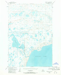
1951 Map of Naknek A-3
USGS Topo · Published 1971About this map
The Becharof Lake shoreline and the upper reaches of the Egegik River dominate this 1951 aerial survey of the Alaska Peninsula. The landscape is defined by a dense network of unnamed thermokarst lakes and tundra wetlands, punctuated by the occasional Cabin or group of Cabins that hint at seasonal hunting or fishing activity. In the southeast, the terrain rises toward localized peaks marked as Vabm 215 Dike, while Shosky Creek meanders through the central interior. This map records the drainage pattern of the region before significant modern development, specifically highlighting the treacherous Rapids where the river exits the lake. The presence of triangulation stations like Vabm 169 Shosky and Vabm 19 Lagoon reflects the mid-century effort by the Geological Survey to provide precise geodetic control in this roadless territory.
Find a feature on this map
14 named features on this map. Tap any name to fly to it.
Don’t see what you’re looking for? This feature index may not catch every label — zoom into the map to look around manually.
Map Details
Editions of this 1951 Naknek A-3 Map
2 editions found
Other maps of this area

1943 · Ugashik
USGS Topo · 1:250,000

1948 · Ugashik
USGS Topo · 1:250,000

1949 · Ugashik
USGS Topo · 1:250,000

1951 · Ugashik D-3
USGS Topo · 1:63,360

1951 · Naknek A-2
USGS Topo · 1:63,360

1951 · Ugashik D-4
USGS Topo · 1:63,360

1951 · Naknek A-4
USGS Topo · 1:63,360

1951 · Ugashik D-2
USGS Topo · 1:63,360

1951 · Naknek A-3
USGS Topo · 1:63,360

1952 · Naknek
USGS Topo · 1:250,000