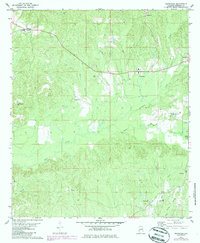
1978 Map of Nanafalia
USGS Topo · Published 1986About this map
Nanafalia and the surrounding rural communities of Marengo County are defined by an intricate network of creeks and small family settlements during this mid-1970s survey. The landscape is heavily dissected by waterways like Sweetwater Creek, Horse Creek, and Pill Berry Creek, which dictate the placement of local roads and farmsteads. Cultural markers for genealogists are abundant, including several established houses of worship such as St Paul Ch and Independent Ch, along with numerous local burial grounds like Hickory Grove Cem and Luker Cem. The map reveals the layout of small hamlets including Nicholsville, Coxheath, and Hoboken, where local infrastructure such as a Substation and a Gaging Station on the creek bank indicate the ongoing management of the area's natural resources and utilities.
Find a feature on this map
32 named features on this map. Tap any name to fly to it.
Don’t see what you’re looking for? This feature index may not catch every label — zoom into the map to look around manually.
Map Details
Editions of this 1978 Nanafalia Map
2 editions found
Other maps of this area

1953 · Montgomery
USGS Topo · 1:250,000

1953 · Andalusia
USGS Topo · 1:250,000

1953 · Hattiesburg
USGS Topo · 1:250,000

1953 · Meridian
USGS Topo · 1:250,000

1956 · Montgomery
USGS Topo · 1:250,000

1957 · Meridian
USGS Topo · 1:250,000

1957 · Montgomery
USGS Topo · 1:250,000

1957 · Andalusia
USGS Topo · 1:250,000

1958 · Hattiesburg
USGS Topo · 1:250,000

1965 · Meridian
USGS Topo · 1:250,000