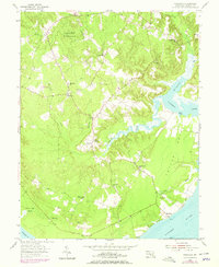
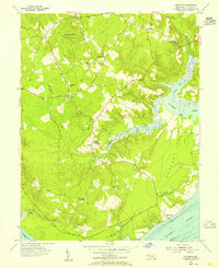
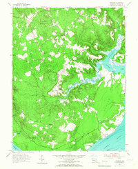
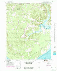
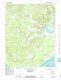
1954 Map of Nanjemoy
USGS Topo · Published 1978About this map
The Doncaster State Forest and the tidal reaches of the Potomac River define this corner of Charles County, Maryland, as it appeared in the mid-20th century. The landscape is shaped by the winding Nanjemoy Creek and its many tributaries, including Taylor Creek and Hill Top Fork, which carve through the dense woodlands and create intricate marshlands like Thorne Gut Marsh. Small rural communities and crossroad settlements such as Nanjemoy, Ironsides, and Grayton are centers of local life, each anchored by small country institutions.
Find a feature on this map
34 named features on this map. Tap any name to fly to it.
Don’t see what you’re looking for? This feature index may not catch every label — zoom into the map to look around manually.
Map Details
Editions of this 1954 Nanjemoy Map
5 editions found
Other maps of this area

1889 · Fredericksburg
USGS Topo · 1:125,000

1890 · Mt. Vernon
USGS Topo · 1:125,000

1891 · Mt. Vernon
USGS Topo · 1:125,000

1892 · Fredericksburg
USGS Topo · 1:125,000

1894 · Fredericksburg
USGS Topo · 1:125,000

1894 · Mt. Vernon
USGS Topo · 1:125,000

1897 · Mt. Vernon
USGS Topo · 1:125,000

1913 · Indian Head
USGS Topo · 1:62,500
1913 · Nanjemoy
USGS Topo · 1:62,500

1923 · Indian Head
USGS Topo · 1:48,000