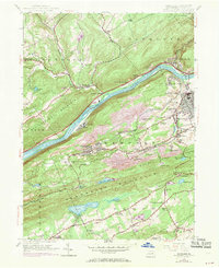
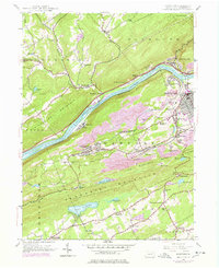
1954 Map of Nanticoke
USGS Topo · Published 1969About this map
The Susquehanna River carves a deep valley through the ridges of Luzerne County, serving as the central artery for a landscape defined by industrial development and institutional presence. Along the river's south bank, the Retreat State Hospital and Retreat settlement stand prominently, while the Penn Central and Erie-Lackawanna rail lines underscore the region's historical reliance on coal transport and heavy transit. To the north, the terrain rises into Shickshinny Mountain, contrasting the dense residential pockets of Nanticoke and Honey Pot with the more rural uplands of Hunlock.
Find a feature on this map
61 named features on this map. Tap any name to fly to it.
Don’t see what you’re looking for? This feature index may not catch every label — zoom into the map to look around manually.
Map Details
Editions of this 1954 Nanticoke Map
5 editions found
Other maps of this area

1891 · Wilkesbarre
USGS Topo · 1:62,500

1891 · Harveys Lake
USGS Topo · 1:62,500

1893 · Harvey Lake
USGS Topo · 1:62,500

1893 · Pittston
USGS Topo · 1:62,500

1894 · Shickshinny
USGS Topo · 1:62,500

1894 · Wilkesbarre
USGS Topo · 1:62,500

1943 · Scranton
USGS Topo · 1:125,000

1946 · Sybertsville
USGS Topo · 1:31,680

1946 · Nanticoke
USGS Topo · 1:31,680

1946 · Shickshinny
USGS Topo · 1:31,680