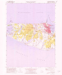
1972 Map of Nantucket
USGS Topo · Published 1973About this map
Nantucket serves as the focal point of this coastal survey, where the dense grid of streets like Main St and Orange St meets the maritime infrastructure of Nantucket Harbor. The map reveals a community deeply tied to its seafaring roots, anchored by Brant Pt Lighthouse and the U S Coast Guard Sta. Away from the town center, the landscape transitions into a series of ponds and swamps, such as Hummock Pond and Millbrook Swamp, while family names are preserved in landmarks like Swain Hill and the Old Settlers Graves.
Find a feature on this map
92 named features on this map. Tap any name to fly to it.
Don’t see what you’re looking for? This feature index may not catch every label — zoom into the map to look around manually.
Map Details
Editions of this 1972 Nantucket Map
4 editions found
Other maps of this area

1887 · Muskeget
USGS Topo · 1:62,500

1889 · Muskeget
USGS Topo · 1:62,500

1889 · Nantucket
USGS Topo · 1:62,500

1893 · Nantucket
USGS Topo · 1:62,500

1893 · Muskeget
USGS Topo · 1:62,500

1899 · Muskeget
USGS Topo · 1:62,500

1901 · Nantucket
USGS Topo · 1:62,500

1942 · Nantucket
USGS Topo · 1:125,000

1944 · Tuckernuck Island
USGS Topo · 1:31,680

1945 · Nantucket
USGS Topo · 1:31,680