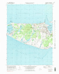
1972 Map of Nantucket
USGS Topo · Published 1978About this map
Nantucket town serves as the focal point of this coastal survey, where the dense grid of streets like Main St and Orange St meets the maritime activity of Nantucket Harbor. The map reveals the island's mid-century landscape, characterized by numerous coastal ponds such as Hummock Pond and Miacomet Pond, and the rolling terrain of Trots Hills. Landmarks including the Lighthouse at Brant Pt and the busy Steamboat Wharf anchor the harbor entrance, while inland areas show a mix of conservation and development, from the Nantucket State Forest to the expanding settlements at Surfside and Cisco.
Find a feature on this map
107 named features on this map. Tap any name to fly to it.
Don’t see what you’re looking for? This feature index may not catch every label — zoom into the map to look around manually.
Map Details
Editions of this 1972 Nantucket Map
4 editions found
Other maps of this area

1887 · Muskeget
USGS Topo · 1:62,500

1889 · Muskeget
USGS Topo · 1:62,500

1889 · Nantucket
USGS Topo · 1:62,500

1893 · Nantucket
USGS Topo · 1:62,500

1893 · Muskeget
USGS Topo · 1:62,500

1899 · Muskeget
USGS Topo · 1:62,500

1901 · Nantucket
USGS Topo · 1:62,500

1942 · Nantucket
USGS Topo · 1:125,000

1944 · Tuckernuck Island
USGS Topo · 1:31,680

1945 · Nantucket
USGS Topo · 1:31,680