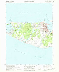
1972 Map of Nantucket
USGS Topo · Published 1978About this map
Nantucket serves as the bustling hub of this island survey, centered on the dense grid of streets leading to Steamboat Wharf and Nantucket Harbor. The town's historical depth is visible in the concentration of civic structures like the Academy Hill Sch and the Museum, along with several burial grounds including Prospect Hill Cemetery and the Old Settlers Graves near Maxcy Pond.
Find a feature on this map
102 named features on this map. Tap any name to fly to it.
Don’t see what you’re looking for? This feature index may not catch every label — zoom into the map to look around manually.
Map Details
Editions of this 1972 Nantucket Map
4 editions found
Other maps of this area

1887 · Muskeget
USGS Topo · 1:62,500

1889 · Muskeget
USGS Topo · 1:62,500

1889 · Nantucket
USGS Topo · 1:62,500

1893 · Nantucket
USGS Topo · 1:62,500

1893 · Muskeget
USGS Topo · 1:62,500

1899 · Muskeget
USGS Topo · 1:62,500

1901 · Nantucket
USGS Topo · 1:62,500

1942 · Nantucket
USGS Topo · 1:125,000

1944 · Tuckernuck Island
USGS Topo · 1:31,680

1945 · Nantucket
USGS Topo · 1:31,680