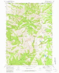
1969 Map of Naomi Peak
USGS Topo · Published 1982About this map
Bear River Range dominates this 1969 survey of high-elevation terrain within the Cache National Forest along the Utah-Idaho border. The high peaks of Mount Gog, Mount Magog, and Naomi Peak anchor the central topography, surrounded by a complex system of glaciated basins and high-altitude lakes. The presence of Steam Mill Canyon and a Mine near City Creek suggests the area's history of small-scale resource extraction, though the landscape is primarily defined by its primitive transportation network of pack and jeep trails.
Find a feature on this map
47 named features on this map. Tap any name to fly to it.
Don’t see what you’re looking for? This feature index may not catch every label — zoom into the map to look around manually.
Map Details
Editions of this 1969 Naomi Peak Map
4 editions found
Other maps of this area

1914 · Logan
USGS Topo · 1:125,000

1915 · Preston
USGS Topo · 1:96,000

1916 · Logan
USGS Topo · 1:125,000

1918 · Preston
USGS Topo · 1:125,000

1954 · Ogden
USGS Topo · 1:250,000

1955 · Preston
USGS Topo · 1:250,000

1958 · Ogden
USGS Topo · 1:250,000

1958 · Preston
USGS Topo · 1:250,000

1960 · Ogden
USGS Topo · 1:250,000

1962 · Preston
USGS Topo · 1:250,000