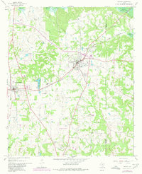
1965 Map of Naples
USGS Topo · Published 1980About this map
Naples and neighboring Omaha serve as the primary hubs in this corner of Northeast Texas, connected by the St Louis Southwestern RR. The landscape is a mixture of woodland and agricultural clearings, defined by a dense network of cemeteries and rural churches that speak to the deep-rooted community history of the region. Notable landmarks include the Greater Morris County Airport to the south and the sprawling Wright Patman Lake along the northern boundary.
Find a feature on this map
38 named features on this map. Tap any name to fly to it.
Don’t see what you’re looking for? This feature index may not catch every label — zoom into the map to look around manually.
Map Details
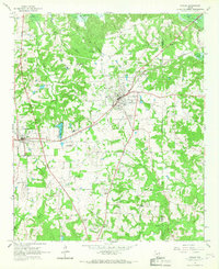
Editions of this 1965 Naples Map
2 editions found
Other maps of this area

1914 · Daingerfield
USGS Topo · 1:62,500

1930 · Bassett
USGS Topo · 1:62,500

1953 · Texarkana
USGS Topo · 1:250,000

1956 · Texarkana
USGS Topo · 1:250,000

1964 · Daingerfield
USGS Topo · 1:24,000

1964 · Cason
USGS Topo · 1:24,000

1965 · Marietta
USGS Topo · 1:24,000

1965 · Dalby Springs
USGS Topo · 1:24,000
1965 · Sardis
USGS Topo · 1:24,000
1965 · Bassett
USGS Topo · 1:24,000