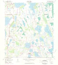
1953 Map of Narcoossee
USGS Topo · Published 1984About this map
Narcoossee serves as the primary settlement in this subtropical landscape, where early 1950s culture and drainage were documented by the U.S. Corps of Engineers. This map illustrates the intricate relationship between Florida's interior water bodies and its early development, notably featuring the Narcoossee Cem and St Luke Ch as central community landmarks. The terrain is dominated by a chain of significant lakes, including Lake Hart, Lake Mary Jane, and the vast East Lake Tohopekaliga. Smaller settlements such as New Eden and Pine Grove are shown along the shores of Lake Center and Lake Lizzie, respectively. To the northeast, the Econlockhatchee River Swamp and Roberts Island Slough highlight the low-lying, marshy nature of the Orange and Osceola county boundary. The presence of a Windmill and various gaging stations reflects the hydraulic management of this lake-rich region during the mid-20th century.
Find a feature on this map
27 named features on this map. Tap any name to fly to it.
Don’t see what you’re looking for? This feature index may not catch every label — zoom into the map to look around manually.
Map Details
Editions of this 1953 Narcoossee Map
5 editions found
Other maps of this area

1953 · Narcoossee NE
USGS Topo · 1:24,000

1953 · Narcoossee SE
USGS Topo · 1:24,000

1953 · St Cloud North
USGS Topo · 1:24,000

1953 · Narcoossee
USGS Topo · 1:24,000

1953 · St Cloud South
USGS Topo · 1:24,000

1953 · Ashton
USGS Topo · 1:24,000

1953 · Holopaw
USGS Topo · 1:24,000

1953 · Pine Castle
USGS Topo · 1:24,000

1953 · Narcoossee NW
USGS Topo · 1:24,000

1955 · Orlando
USGS Topo · 1:250,000