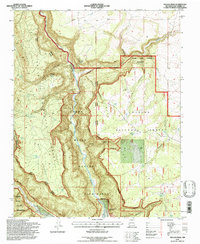
1995 Map of Navajo Peak
USGS Topo · Published 1997About this map
Christ of the Desert Monastery sits along the winding course of the Rio Chama within a landscape defined by the deep incisions of the Chama River Canyon Wilderness. This 1990s revision reveals a rugged canyon system where the river meets the Gallina River at the southern boundary of the quadrangle. The topography is dominated by massive elevated features like Mesa Golondrina and the sharp rise of Navajo Peak, while the northern portion is marked by The Hogback. Numerous isolated water sources, such as Valdez Tank and Sapa Tank, serve as vital landmarks for navigation through the Coyote Ranger District and surrounding national forests. The transition between the Santa Fe and Carson national forests is clearly delineated, showing a remote backcountry preserved for wilderness value, accessible primarily through canyons like Lobo Canyon and Chavez Canyon.
Find a feature on this map
39 named features on this map. Tap any name to fly to it.
Don’t see what you’re looking for? This feature index may not catch every label — zoom into the map to look around manually.
Map Details
Editions of this 1995 Navajo Peak Map
This is the sole edition of this map. No revisions or reprints were ever made.
Other maps of this area

1909 · Gallina
USGS Topo · 1:125,000

1953 · Alire
USGS Topo · 1:24,000

1953 · Echo Ampitheater
USGS Topo · 1:24,000

1953 · Laguna Peak
USGS Topo · 1:24,000

1953 · Navajo Peak
USGS Topo · 1:24,000

1954 · Aztec
USGS Topo · 1:250,000

1955 · Llaves
USGS Topo · 1:62,500

1955 · Tierra Amarilla
USGS Topo · 1:62,500

1955 · Boulder Lake
USGS Topo · 1:62,500

1958 · Aztec
USGS Topo · 1:250,000