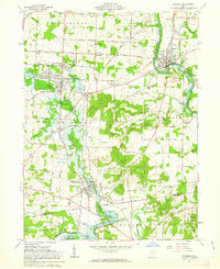
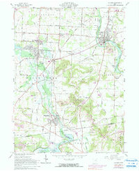
1961 Map of Navarre
USGS Topo · Published 1963About this map
The Tuscarawas River valley in the early 1960s reveals a complex landscape of heavy industry and rural heritage at the intersection of Stark and Tuscarawas Counties. The presence of the Ohio and Erie Canal alongside the Baltimore and Ohio and New York Chicago and St Louis railroads underscores the area's role as a transportation corridor. Extensive extractive activity is visible through numerous labeled strip mines and the Fox Mine north of Smoketown.
Find a feature on this map
76 named features on this map. Tap any name to fly to it.
Don’t see what you’re looking for? This feature index may not catch every label — zoom into the map to look around manually.
Map Details
Editions of this 1961 Navarre Map
5 editions found
Other maps of this area

1901 · Massillon
USGS Topo · 1:62,500

1901 · Canton
USGS Topo · 1:62,500

1903 · Massillon
USGS Topo · 1:62,500

1903 · Canton
USGS Topo · 1:62,500

1912 · Dover
USGS Topo · 1:62,500

1914 · Navarre
USGS Topo · 1:62,500

1944 · Navarre
USGS Topo · 1:62,500

1944 · Dover
USGS Topo · 1:62,500

1951 · Canton
USGS Topo · 1:250,000

1951 · Bolivar
USGS Topo · 1:24,000
Featured Places
- Massillon, OH
- Brewster, Sugar Creek Township
- Navarre, OH
- Beach City, Sugar Creek Township
- Sugar Creek Township, OH