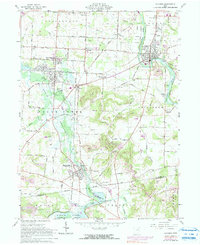
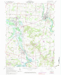
1961 Map of Navarre
USGS Topo · Published 1990About this map
The Tuscarawas River valley in the early 1960s was a landscape defined by industrial transitions and extensive water management. This area in Stark and Tuscarawas counties shows the clear path of the Ohio Canal (Abandoned), which once served as a primary trade artery, now superseded by the complex rail networks of the Baltimore and Ohio and Norfolk and Western railroads. Heavy coal mining activity is evident through numerous Strip Mines and the Fox Mine scattered across the ridge lines.
Find a feature on this map
50 named features on this map. Tap any name to fly to it.
Don’t see what you’re looking for? This feature index may not catch every label — zoom into the map to look around manually.
Map Details
Editions of this 1961 Navarre Map
5 editions found
Other maps of this area

1901 · Massillon
USGS Topo · 1:62,500

1901 · Canton
USGS Topo · 1:62,500

1903 · Massillon
USGS Topo · 1:62,500

1903 · Canton
USGS Topo · 1:62,500

1912 · Dover
USGS Topo · 1:62,500

1914 · Navarre
USGS Topo · 1:62,500

1944 · Navarre
USGS Topo · 1:62,500

1944 · Dover
USGS Topo · 1:62,500

1951 · Canton
USGS Topo · 1:250,000

1951 · Bolivar
USGS Topo · 1:24,000