
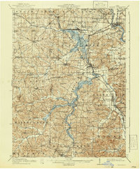
1914 Map of Navarre
USGS Topo · Published 1940About this map
Sugar Creek winds through a landscape defined by the intersection of three counties—Wayne, Stark, and Tuscarawas—during a period of significant industrial and hydraulic development. The massive Dover Reservoir dominates the eastern corridor, while the historic Military Treaty Line cuts an angled path across the central townships. The infrastructure of the era is remarkably dense, featuring the heavy industrial presence of the Pennsylvania System and the Wheeling and Lake Erie railroads, which served coal operations like the Fox Mine.
Find a feature on this map
100 named features on this map. Tap any name to fly to it.
Don’t see what you’re looking for? This feature index may not catch every label — zoom into the map to look around manually.
Map Details
Editions of this 1914 Navarre Map
2 editions found
Other maps of this area

1901 · Massillon
USGS Topo · 1:62,500

1901 · Canton
USGS Topo · 1:62,500

1901 · Wooster
USGS Topo · 1:62,500

1903 · Massillon
USGS Topo · 1:62,500

1903 · Wooster
USGS Topo · 1:62,500

1903 · Canton
USGS Topo · 1:62,500

1909 · Uhrichsville
USGS Topo · 1:62,500

1911 · Uhrichsville
USGS Topo · 1:62,500

1911 · Newcomerstown
USGS Topo · 1:62,500

1912 · Dover
USGS Topo · 1:62,500