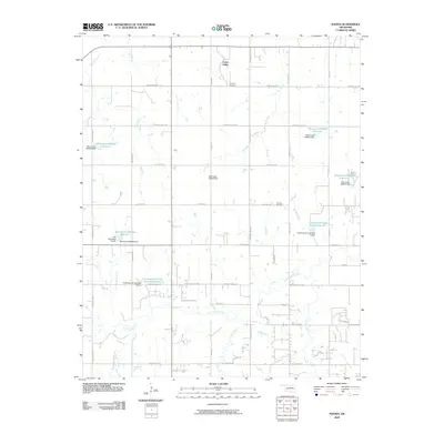
2009 Map of Navina
USGS Topo · Published 2009About this map
Cedar Valley sits at the northern edge of this Logan County landscape, where the rural character of central Oklahoma is defined by a complex network of tributaries and managed water resources. The terrain is etched by Cottonwood Creek and its various branches, including Gar Creek and Cox Creek, which support numerous engineered reservoirs such as Cottonwood Creek Site 5 Reservoir and Cottonwood Creek Site 8 Reservoir. These water management sites, often identified by local dam designations like Oknoname 083050 Dam, illustrate the 21st-century agricultural and hydrological infrastructure essential to the region.
Find a feature on this map
39 named features on this map. Tap any name to fly to it.
Don’t see what you’re looking for? This feature index may not catch every label — zoom into the map to look around manually.
Map Details
Editions of this 2009 Navina Map
This is the sole edition of this map. No revisions or reprints were ever made.
Other maps of this area

1892 · Guthrie
USGS Topo · 1:62,500

1892 · Edmond
USGS Topo · 1:62,500

1892 · Kingfisher
USGS Topo · 1:125,000

1895 · Kingfisher
USGS Topo · 1:125,000

1935 · Edmond
USGS Topo · 1:48,000

1940 · Edmond
USGS Topo · 1:62,500

1954 · Oklahoma City
USGS Topo · 1:250,000

1957 · Oklahoma City
USGS Topo · 1:250,000

1963 · Oklahoma City
USGS Topo · 1:250,000
1966 · Edmond
USGS Topo · 1:24,000