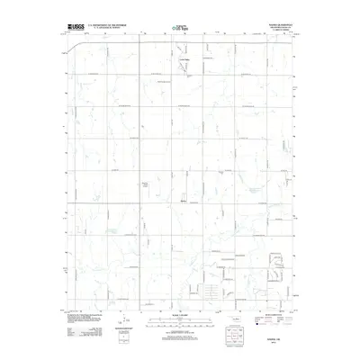
2012 Map of Navina
USGS Topo · Published 2012About this map
The settlement of Navina serves as the central point for this rural portion of Logan County, Oklahoma. This landscape is defined by the drainage networks of Cottonwood Cr and its tributaries, including Deer Cr and Chisholm Cr, which flow through the rolling plains north of the Oklahoma City metropolitan area. The map illustrates a transition toward suburban development, particularly in the northern section around Cedar Valley, where residential patterns like Cedar Valley Mnr and Fairway Dr emerge alongside traditional agriculture. Local heritage is preserved at sites like Harmony Cem and Fairview Cem, while the aviation needs of the area are met by Hawk Haven Airport and Winding Creek Airport. Water management is evident through engineering projects such as the Cottonwood Cr Site 8 Reservoir, reflecting the region's historical efforts to control seasonal flooding and support local land use.
Find a feature on this map
66 named features on this map. Tap any name to fly to it.
Don’t see what you’re looking for? This feature index may not catch every label — zoom into the map to look around manually.
Map Details
Editions of this 2012 Navina Map
This is the sole edition of this map. No revisions or reprints were ever made.
Other maps of this area

1892 · Guthrie
USGS Topo · 1:62,500

1892 · Edmond
USGS Topo · 1:62,500

1892 · Kingfisher
USGS Topo · 1:125,000

1895 · Kingfisher
USGS Topo · 1:125,000

1935 · Edmond
USGS Topo · 1:48,000

1940 · Edmond
USGS Topo · 1:62,500

1954 · Oklahoma City
USGS Topo · 1:250,000

1957 · Oklahoma City
USGS Topo · 1:250,000

1963 · Oklahoma City
USGS Topo · 1:250,000
1966 · Edmond
USGS Topo · 1:24,000