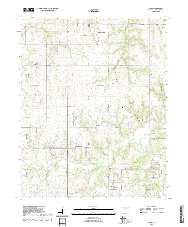
2022 Map of Navina
USGS Topo · Published 2022About this map
Navina and Cedar Valley serve as the primary focal points of this Logan County landscape, where the prairie begins to transition into more complex drainage networks. The area is defined by its water management and agricultural infrastructure, featuring numerous reservoirs such as 083042 Reservoir and several flood control structures along Cottonwood Creek. The township boundaries of t16n r4w and t15n r3w organize a grid of rural roads, including S Portland Ave and W Seward Rd, which connect scattered homesteads and local landmarks. Aviation history is represented by Winding Creek Airport and Highley Field, while local genealogy is grounded in sites like Fairview Cem and Harmony Cem. This survey illustrates a modern rural Oklahoma community where residential pockets and small-scale airfields coexist with the winding paths of Deer Creek and Chisholm Creek.
Find a feature on this map
58 named features on this map. Tap any name to fly to it.
Don’t see what you’re looking for? This feature index may not catch every label — zoom into the map to look around manually.
Map Details
Editions of this 2022 Navina Map
This is the sole edition of this map. No revisions or reprints were ever made.
Other maps of this area

1892 · Guthrie
USGS Topo · 1:62,500

1892 · Edmond
USGS Topo · 1:62,500

1892 · Kingfisher
USGS Topo · 1:125,000

1895 · Kingfisher
USGS Topo · 1:125,000

1935 · Edmond
USGS Topo · 1:48,000

1940 · Edmond
USGS Topo · 1:62,500

1954 · Oklahoma City
USGS Topo · 1:250,000

1957 · Oklahoma City
USGS Topo · 1:250,000

1963 · Oklahoma City
USGS Topo · 1:250,000
1966 · Edmond
USGS Topo · 1:24,000