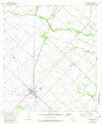
1953 Map of Needville
USGS Topo · Published 1980About this map
Needville stands as the primary hub of this Fort Bend County landscape, which transitions from organized town blocks to an expansive network of agriculture and energy extraction. The Southern Pacific railroad corridor and the Memorial Highway define the local transport pattern, linking the settlement of Needville to smaller rural clusters like Fairchilds and Pleak. A series of levees and gaging stations along Big Creek and Fairchilds Creek highlight the importance of water management in this low-lying region, where the terrain is punctuated by numerous windmills and oil infrastructure.
Find a feature on this map
21 named features on this map. Tap any name to fly to it.
Don’t see what you’re looking for? This feature index may not catch every label — zoom into the map to look around manually.
Map Details
Editions of this 1953 Needville Map
3 editions found
Other maps of this area

1950 · Houston
USGS Topo · 1:250,000

1953 · Needville
USGS Topo · 1:24,000

1953 · Guy
USGS Topo · 1:24,000

1953 · Lake George
USGS Topo · 1:24,000

1953 · Kendleton
USGS Topo · 1:24,000

1953 · Damon
USGS Topo · 1:24,000

1953 · Boling
USGS Topo · 1:24,000

1955 · Sugar Land
USGS Topo · 1:62,500

1955 · Richmond
USGS Topo · 1:62,500

1956 · Houston
USGS Topo · 1:250,000