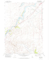
1971 Map of Neeley
USGS Topo · Published 1974About this map
Snake River bends and flows through this high-desert landscape in the early 1970s, serving as a primary corridor for both frontier history and modern irrigation. The map highlights the Massacre Rocks State Park and the nearby Hunt Party Historical Site, marking significant points on the historic Oregon Trail. The settlement of Neeley sits along the riverbanks, where the community's local history is anchored by the Neeley Cem.
Find a feature on this map
27 named features on this map. Tap any name to fly to it.
Don’t see what you’re looking for? This feature index may not catch every label — zoom into the map to look around manually.
Map Details
Editions of this 1971 Neeley Map
This is the sole edition of this map. No revisions or reprints were ever made.
Other maps of this area

1934 · American Falls
USGS Topo · 1:62,500

1934 · Rockland
USGS Topo · 1:62,500

1936 · American Falls
USGS Topo · 1:62,500

1937 · Rockland
USGS Topo · 1:62,500

1954 · Pocatello
USGS Topo · 1:250,000

1958 · Pocatello
USGS Topo · 1:250,000

1959 · Yale
USGS Topo · 1:62,500

1971 · Rockland East
USGS Topo · 1:24,000
1971 · Indian Springs
USGS Topo · 1:24,000
1971 · American Falls SW
USGS Topo · 1:24,000