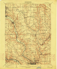
1907 Map of Neshannock
USGS Topo · Published 1915About this map
The Shenango River and Neshannock Creek valley corridors define this early 20th-century landscape, where heavy industry and rural life converged. The northern reaches are dominated by the industrial growth of Sharon and South Sharon, while the southern portion reveals the burgeoning urban grid of New Castle. Between these hubs, the terrain is dotted with small agricultural settlements like West Middlesex, Pulaski, and New Wilmington, the latter featuring a local Reservoir.
Find a feature on this map
95 named features on this map. Tap any name to fly to it.
Don’t see what you’re looking for? This feature index may not catch every label — zoom into the map to look around manually.
Map Details
Editions of this 1907 Neshannock Map
5 editions found
Other maps of this area

1902 · New Castle
USGS Topo · 1:62,500

1904 · Newcastle
USGS Topo · 1:62,500

1905 · Neshannock
USGS Topo · 1:62,500

1906 · Youngstown
USGS Topo · 1:62,500

1907 · Neshannock
USGS Topo · 1:62,500

1907 · Kinsman
USGS Topo · 1:62,500

1907 · Columbiana
USGS Topo · 1:62,500

1908 · Shenango
USGS Topo · 1:62,500

1908 · Youngstown
USGS Topo · 1:62,500

1908 · Zelienople
USGS Topo · 1:62,500