
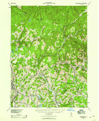
1942 Map of Neversink
USGS Topo · Published 1958About this map
Liberty and Grahamsville anchor this mid-century topographic portrait of the Catskill region, where the Neversink River and its East Branch carve through a landscape of high peaks and isolated valleys. Compiled from 1942 aerial photography, the map reveals the complex drainage systems of the Beaver Kill and Willowemoc Creek, highlighting the importance of water resources to the local economy and geography. Smaller hamlets like Loch Sheldrake, Woodbourne, and Claryville are connected by a network of winding roads, while the presence of the Nyo And W Rr in the southwest near Ferndale points to the area's historical rail connections. Numerous glacial features are evident, from the high elevation of Denman Mt and Red Hill to the scattered waters of Hodge Pond, Mongaup Pond, and Sheldrake Pond. Local landmarks such as the Union Ch and various bench marks provide specific points of interest for genealogical and historical research.
Find a feature on this map
70 named features on this map. Tap any name to fly to it.
Don’t see what you’re looking for? This feature index may not catch every label — zoom into the map to look around manually.
Map Details
Editions of this 1942 Neversink Map
2 editions found
Other maps of this area

1900 · Phoenicia
USGS Topo · 1:62,500

1901 · Margaretville
USGS Topo · 1:62,500

1903 · Phoenicia
USGS Topo · 1:62,500

1903 · Slide Mountain
USGS Topo · 1:62,500

1904 · Margaretville
USGS Topo · 1:62,500

1904 · Ellenville
USGS Topo · 1:62,500

1905 · Slide Mountain
USGS Topo · 1:62,500

1906 · Ellenville
USGS Topo · 1:62,500

1909 · Monticello
USGS Topo · 1:62,500

1910 · Neversink
USGS Topo · 1:62,500