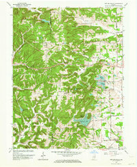
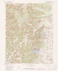
1962 Map of New Bellsville
USGS Topo · Published 1964About this map
The hills of Washington and Harrison townships define this section of Bartholomew and Brown counties, where the land transitions from the high ridges of Fourmile Ridge to the developed lakeside communities near Ogilville. By the early 1960s, the landscape featured several prominent artificial water bodies, including the tiered levels of North Harrison Lake, South Harrison Lake, and the expansive Grandview Lake with its spillway at 715 feet. To the north, the Camp Atterbury Military Reservation occupies a significant portion of the terrain, its boundary running along Catherine Creek. Local history is anchored by several rural landmarks such as Mt Carmel Ch, New Zion Ch, and family cemeteries like Dobbs Cem and Haislup Cem. The map documents established crossroads and hamlets including Georgetown, North Salem, and New Bellsville, reflecting the mid-century settlement pattern of south-central Indiana.
Find a feature on this map
62 named features on this map. Tap any name to fly to it.
Don’t see what you’re looking for? This feature index may not catch every label — zoom into the map to look around manually.
Map Details
Editions of this 1962 New Bellsville Map
5 editions found
Other maps of this area

1942 · Franklin
USGS Topo · 1:125,000

1942 · Columbus
USGS Topo · 1:125,000

1947 · Nashville
USGS Topo · 1:24,000

1947 · Franklin
USGS Topo · 1:62,500

1948 · Edinburg
USGS Topo · 1:24,000

1948 · New Bellsville
USGS Topo · 1:24,000

1948 · Waymansville
USGS Topo · 1:24,000

1948 · Nineveh
USGS Topo · 1:24,000

1948 · Fruitdale
USGS Topo · 1:24,000

1949 · Nashville
USGS Topo · 1:24,000