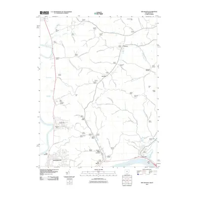
2010 Map of New Boston
USGS Topo · Published 2010About this map
Harrison Furnace stands as a testament to the iron industrial legacy of the region, situated along the eastern edge of this 2010 topographic study. The landscape is defined by the confluence of the Ohio River, the Scioto River, and the Little Scioto River, which frame the urban developments of Portsmouth, New Boston, and Sciotoville. Inland, the terrain is deeply dissected by a dense network of named hollows such as Burns Hollow, Greenbrier Hollow, and Whippoorwill Hollow, reflecting the complex drainage patterns feeding into the river valleys. Cultural landmarks including the Woods Ridge Lookout Tower and numerous family and church burial grounds like Summers Cemetery and Stony Hill Cemetery provide significant points of interest for local history researchers and genealogists tracing the settlement patterns north of the river.
Find a feature on this map
109 named features on this map. Tap any name to fly to it.
Don’t see what you’re looking for? This feature index may not catch every label — zoom into the map to look around manually.
Map Details
Editions of this 2010 New Boston Map
This is the sole edition of this map. No revisions or reprints were ever made.
Other maps of this area

1911 · Sciotoville
USGS Topo · 1:62,500

1913 · Sciotoville
USGS Topo · 1:62,500

1915 · Garrison
USGS Topo · 1:62,500

1915 · Otway
USGS Topo · 1:62,500

1917 · Otway
USGS Topo · 1:62,500

1918 · Garrison
USGS Topo · 1:62,500

1926 · Greenup
USGS Topo · 1:48,000

1930 · Greenup
USGS Topo · 1:62,500

1949 · Friendship
USGS Topo · 1:24,000
1951 · Friendship
USGS Topo · 1:24,000