1985 Map of New Braunfels
USGS Topo · Published 1985About this map
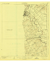
The Guadalupe River carves through the heart of this Central Texas landscape, anchoring a region defined by established Hill Country towns and expanding military installations. In the mid-1980s, the urban footprint of San Antonio is seen pushing northward toward the Camp Bullis Military Reservation and Camp Stanley, while Randolph Air Force Base stands as a major landmark to the southeast. The map details the historic German-influenced settlements of the area, including Gruene, Boerne, and Sisterdale, alongside the essential water resources of Canyon Lake and Medina Lake. The transportation network is dominated by the corridors of Interstate 35 and Interstate 10, which connect these smaller communities to the larger metropolitan centers. Cultural landmarks such as Holy Cross Cem and the Guadalupe River State Park offer points of interest for genealogists and local historians tracing the development of Comal and Kendall counties.
Find a feature on this map
76 named features on this map. Tap any name to fly to it.
Don’t see what you’re looking for? This feature index may not catch every label — zoom into the map to look around manually.
Map Details
Editions of this 1985 New Braunfels Map
This is the sole edition of this map. No revisions or reprints were ever made.
Historical Maps of San Antonio Through Time
3 maps found