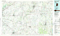
1986 Map of New Castle
USGS Topo · Published 1986About this map
The Big Blue River and Sugar Creek drainage basins define the rural and industrial landscape of East Central Indiana in this mid-1980s compilation. Regional hubs like New Castle, Greenfield, and Connersville are shown at the height of their twentieth-century development, connected by a dense lattice of transportation corridors including Interstate 70 and the historic U.S. Highway 40. The map documents the extensive rail infrastructure of the era, featuring the Conrail and Norfolk and Western lines that once powered the local manufacturing economy.
Find a feature on this map
136 named features on this map. Tap any name to fly to it.
Don’t see what you’re looking for? This feature index may not catch every label — zoom into the map to look around manually.
Map Details
Editions of this 1986 New Castle Map
2 editions found
Other maps of this area

1915 · New Paris
USGS Topo · 1:48,000

1915 · College Corner
USGS Topo · 1:48,000

1915 · Harrison
USGS Topo · 1:48,000

1916 · Winchester
USGS Topo · 1:48,000

1918 · Winchester
USGS Topo · 1:62,500

1918 · College Corner
USGS Topo · 1:62,500

1918 · New Paris
USGS Topo · 1:62,500

1942 · Franklin
USGS Topo · 1:125,000

1942 · Columbus
USGS Topo · 1:125,000

1943 · Winchester
USGS Topo · 1:62,500