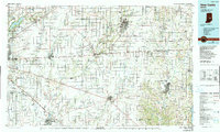
1986 Map of New Castle
USGS Topo · Published 1990About this map
Fort Benjamin Harrison Military Reservation stands on the western edge of this East Central Indiana landscape, anchoring a region defined by its productive agricultural plains and growing suburban centers. The map documents the mid-1980s expansion of communities like Greenfield, New Castle, and Shelbyville, connected by a dense lattice of transportation corridors including I-70 and the Conrail line. Water remains a central geographic feature, with the Big Blue River and Flatrock River cutting southwesterly paths across the county lines of Hancock, Henry, and Wayne. Large reservoirs such as Geist Reservoir and the northern reaches of Brookville Lake highlight the engineering of the era to manage the region's complex drainage. Smaller 19th-century settlements like Knightstown, Cambridge City, and Spiceland maintain their distinct footprints along the historic U.S. 40 corridor, reflecting the area's transition from a rural rail-and-road economy toward modern metropolitan integration.
Find a feature on this map
156 named features on this map. Tap any name to fly to it.
Don’t see what you’re looking for? This feature index may not catch every label — zoom into the map to look around manually.
Map Details
Editions of this 1986 New Castle Map
2 editions found
Other maps of this area

1915 · New Paris
USGS Topo · 1:48,000

1915 · College Corner
USGS Topo · 1:48,000

1915 · Harrison
USGS Topo · 1:48,000

1916 · Winchester
USGS Topo · 1:48,000

1918 · Winchester
USGS Topo · 1:62,500

1918 · College Corner
USGS Topo · 1:62,500

1918 · New Paris
USGS Topo · 1:62,500

1942 · Franklin
USGS Topo · 1:125,000

1942 · Columbus
USGS Topo · 1:125,000

1943 · Winchester
USGS Topo · 1:62,500