2010 Map of New Deal
USGS Topo · Published 2010About this map
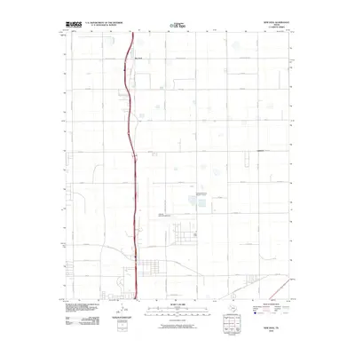
New Deal serves as the primary settlement in this High Plains landscape, situated just north of the expanding infrastructure of Lubbock. The area is defined by a rigorous grid of section-line roads and the massive footprint of the Lubbock International Airport, which dominates the southern half of the quadrangle. This 2010 survey illustrates the transition from rural agricultural plots to suburban and industrial development, marked by the extensive naming of thoroughfares like University Ave and MLK Jr Blvd. Water management is represented by the Lubbock Terminal Reservoir Levee, a critical piece of local utility infrastructure. The map provides a clear look at the residential layout of New Deal and the coordinated road network, including Macalester Ave and E Bluefield St, which facilitate movement between the small town and the neighboring airport complex.
Find a feature on this map
40 named features on this map. Tap any name to fly to it.
Don’t see what you’re looking for? This feature index may not catch every label — zoom into the map to look around manually.
Map Details
Editions of this 2010 New Deal Map
This is the sole edition of this map. No revisions or reprints were ever made.
Other maps of this area

1954 · Lubbock
USGS Topo · 1:250,000

1956 · Shallowater
USGS Topo · 1:24,000

1956 · New Deal
USGS Topo · 1:24,000

1957 · Lubbock East
USGS Topo · 1:24,000

1957 · Lubbock West
USGS Topo · 1:24,000

1957 · Lubbock
USGS Topo · 1:62,500

1957 · Abernathy
USGS Topo · 1:62,500

1965 · Buffalo Springs Lake
USGS Topo · 1:24,000

1965 · Idalou
USGS Topo · 1:24,000

1965 · Heckville
USGS Topo · 1:24,000