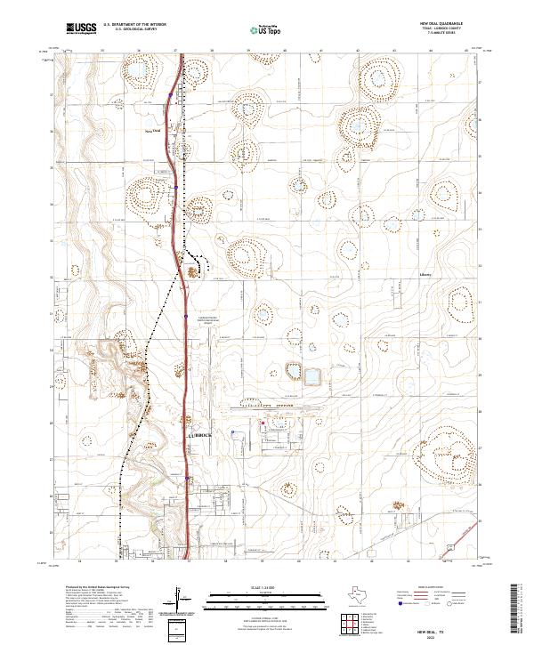
2022 Map of New Deal
USGS Topo · Published 2022About this map
New Deal serves as the northern anchor of this landscape, situated along a transportation corridor that links the smaller community of Liberty with the northern urban reaches of Lubbock. The map illustrates a high-plains geography defined by the ephemeral path of Blackwater Draw, which cuts diagonally across the western sections. The agricultural grid is densely populated with local road networks like Macalester Ave, N Aspen Ave, and S Emory Ave, reflecting a region structured for both large-scale farming and the logistics of the Southern High Plains. A significant portion of the central terrain is occupied by the Lubbock Preston Smith International Airport, showing the intersection of rural land use with essential regional aviation infrastructure. The layout of streets such as Broadway and the various numbered county roads suggests a community built on a rigorous survey system, maintaining its rural-to-urban transition during the early 2020s.
Find a feature on this map
86 named features on this map. Tap any name to fly to it.
Don’t see what you’re looking for? This feature index may not catch every label — zoom into the map to look around manually.
Map Details
Editions of this 2022 New Deal Map
This is the sole edition of this map. No revisions or reprints were ever made.
Other maps of this area

1954 · Lubbock
USGS Topo · 1:250,000

1956 · Shallowater
USGS Topo · 1:24,000

1956 · New Deal
USGS Topo · 1:24,000

1957 · Lubbock East
USGS Topo · 1:24,000

1957 · Lubbock West
USGS Topo · 1:24,000

1957 · Lubbock
USGS Topo · 1:62,500

1957 · Abernathy
USGS Topo · 1:62,500

1965 · Buffalo Springs Lake
USGS Topo · 1:24,000

1965 · Idalou
USGS Topo · 1:24,000

1965 · Heckville
USGS Topo · 1:24,000