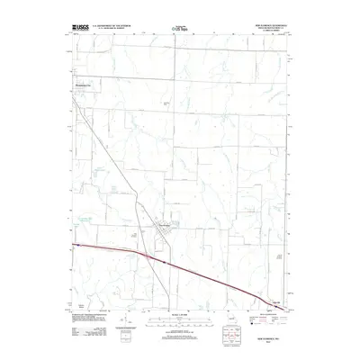
2012 Map of New Florence
USGS Topo · Published 2012About this map
New Florence serves as a central hub in this Montgomery County landscape, situated along the historic corridor of Booneslick Rd. The town layout is clearly defined, with S Adams St and Mortimer St anchoring the residential and commercial core. To the north, the terrain is characterized by a series of north-flowing waterways including Elkhorn Creek, Wolf Creek, and Little Wolf Creek, which carve through the agricultural land. Smaller settlements like High Hill and the southern edge of Montgomery City are visible, connected by a network of county roads such as Vandiver Rd and Davis Rd.
Find a feature on this map
76 named features on this map. Tap any name to fly to it.
Don’t see what you’re looking for? This feature index may not catch every label — zoom into the map to look around manually.
Map Details
Editions of this 2012 New Florence Map
This is the sole edition of this map. No revisions or reprints were ever made.
Other maps of this area

1890 · Louisiana
USGS Topo · 1:125,000

1890 · Mexico
USGS Topo · 1:125,000

1890 · Hermann
USGS Topo · 1:125,000

1890 · Fulton
USGS Topo · 1:125,000

1940 · Montgomery City
USGS Topo · 1:62,500

1942 · Montgomery City
USGS Topo · 1:62,500

1942 · Wellsville
USGS Topo · 1:62,500

1942 · New Florence
USGS Topo · 1:62,500

1942 · Bellflower
USGS Topo · 1:62,500

1945 · Bellflower
USGS Topo · 1:62,500