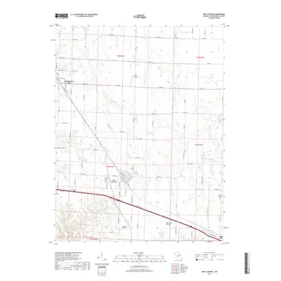
2017 Map of New Florence
USGS Topo · Published 2017About this map
Montgomery City and New Florence anchor this Montgomery County landscape, situated along a vital transportation corridor defined by the Norfolk Southern railroad and the modern interstate. The terrain is deeply etched by a network of waterways, including Elkhorn Cr, Wolf Cr, and Clear Fork, which feed into local reservoirs like Carl Dreyer Lake and Pierson Lake. Local history and genealogy researchers will find several significant landmarks, notably the New Florence Cem and Mount Pleasant Cem, alongside distinctive topographical features such as Calhoun Hollow and Mary White Hollow. Small-scale aviation is represented by Wilkins Airport, while the settlement of High Hill marks the southeastern corner of the study area. This survey illustrates the persistent importance of the rail line and state highways in shaping the development of these Missouri communities.
Find a feature on this map
94 named features on this map. Tap any name to fly to it.
Don’t see what you’re looking for? This feature index may not catch every label — zoom into the map to look around manually.
Map Details
Editions of this 2017 New Florence Map
This is the sole edition of this map. No revisions or reprints were ever made.
Other maps of this area

1890 · Louisiana
USGS Topo · 1:125,000

1890 · Mexico
USGS Topo · 1:125,000

1890 · Hermann
USGS Topo · 1:125,000

1890 · Fulton
USGS Topo · 1:125,000

1940 · Montgomery City
USGS Topo · 1:62,500

1942 · Montgomery City
USGS Topo · 1:62,500

1942 · Wellsville
USGS Topo · 1:62,500

1942 · New Florence
USGS Topo · 1:62,500

1942 · Bellflower
USGS Topo · 1:62,500

1945 · Bellflower
USGS Topo · 1:62,500