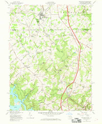
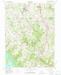
1958 Map of New Freedom
USGS Topo · Published 1969About this map
The Mason and Dixon Line serves as the central anchor for this late 1950s survey, delineating the border between Shrewsbury in Pennsylvania and Baltimore County, Maryland. The corridor is dominated by the north-south path of the Pennsylvania RR, which connects the larger settlement of New Freedom down through Bentley Springs to Parkton. This rail infrastructure, combined with historic roadways like Old York Road, highlights a landscape of 19th-century rural industry and community life.
Find a feature on this map
69 named features on this map. Tap any name to fly to it.
Don’t see what you’re looking for? This feature index may not catch every label — zoom into the map to look around manually.
Map Details
Editions of this 1958 New Freedom Map
5 editions found
Other maps of this area

1900 · Parkton
USGS Topo · 1:62,500

1902 · Parkton
USGS Topo · 1:62,500

1905 · Westminster
USGS Topo · 1:62,500

1908 · York
USGS Topo · 1:62,500

1910 · York
USGS Topo · 1:62,500

1920 · Hanover
USGS Topo · 1:62,500

1922 · Hanover
USGS Topo · 1:62,500

1944 · New Freedom
USGS Topo · 1:31,680

1944 · Hampstead
USGS Topo · 1:31,680
1944 · Hereford
USGS Topo · 1:31,680