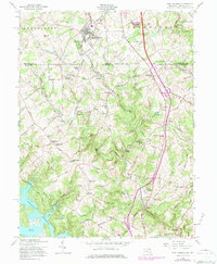
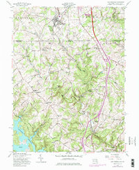
1958 Map of New Freedom
USGS Topo · Published 1984About this map
The Mason and Dixon Line serves as the central axis for this topographic study, dividing Shrewsbury in Pennsylvania from the northern reaches of Maryland's Baltimore County. The settlement of New Freedom anchors the northern portion of the map, characterized by a concentration of residential structures and the religious focal point of New Freedom Ch. Moving south across the border, the terrain transitions into a landscape defined by the winding course of Gunpowder Falls and the significant indentation of the Prettyboy Reservoir at the southwestern corner, including Frog Hollow Cove and the aptly named Spook Hill.
Find a feature on this map
82 named features on this map. Tap any name to fly to it.
Don’t see what you’re looking for? This feature index may not catch every label — zoom into the map to look around manually.
Map Details
Editions of this 1958 New Freedom Map
5 editions found
Other maps of this area

1900 · Parkton
USGS Topo · 1:62,500

1902 · Parkton
USGS Topo · 1:62,500

1905 · Westminster
USGS Topo · 1:62,500

1908 · York
USGS Topo · 1:62,500

1910 · York
USGS Topo · 1:62,500

1920 · Hanover
USGS Topo · 1:62,500

1922 · Hanover
USGS Topo · 1:62,500

1944 · New Freedom
USGS Topo · 1:31,680

1944 · Hampstead
USGS Topo · 1:31,680
1944 · Hereford
USGS Topo · 1:31,680