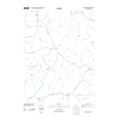
2013 Map of New Freeport
USGS Topo · Published 2013About this map
The New Freeport settlement sits at the confluence of Pennsylvania Fork Fish Cr and Hamilton Run, anchoring this rural landscape in southwestern Greene County. The area is defined by a dense network of winding township roads and named hollows, including Strawn Hollow and Monkey Hollow, which follow the complex drainage of the Dunkard Fork. Smaller agricultural hamlets like Aleppo, Bristoria, and Deep Valley are connected by historically significant routes such as Aleppo Rd and Green Valley Rd. The map reveals a highly dissected terrain where ridges like Mount Carmel Ridge and high points like Windy Gap dictate the placement of early homesteads and roads. For local historians, the specific naming of remote junctions like McCracken and Morford provides evidence of the enduring family-based geography that characterizes this corner of Pennsylvania near the West Virginia border.
Find a feature on this map
90 named features on this map. Tap any name to fly to it.
Don’t see what you’re looking for? This feature index may not catch every label — zoom into the map to look around manually.
Map Details
Editions of this 2013 New Freeport Map
This is the sole edition of this map. No revisions or reprints were ever made.
Other maps of this area

1903 · Littleton
USGS Topo · 1:62,500

1904 · Cameron
USGS Topo · 1:62,500

1905 · Mannington
USGS Topo · 1:62,500

1905 · Rogersville
USGS Topo · 1:62,500

1905 · Littleton
USGS Topo · 1:62,500

1923 · Mannington
USGS Topo · 1:62,500

1924 · Littleton
USGS Topo · 1:62,500

1926 · Littleton
USGS Topo · 1:62,500

1926 · Mannington
USGS Topo · 1:62,500

1935 · Cameron
USGS Topo · 1:62,500
Featured Places
- Aleppo Township, PA
- Freeport Township, PA
- Jackson Township, PA
- Richhill Township, PA
- Gilmore Township, PA