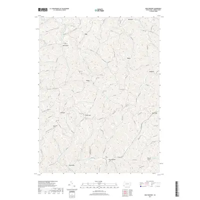
2019 Map of New Freeport
USGS Topo · Published 2019About this map
Aleppo and New Freeport serve as the primary hubs in this remote portion of southwestern Pennsylvania, where the landscape is defined by the branching tributaries of the S Fork Dunkard Fork and Pennsylvania Fork Fish Cr. The terrain is marked by prominent high points like Mt Carmel Ridge and the winding path of the Warrior Trail, which traverses the central ridges. This survey provides a clear view of the deep rural character of Greene County in the late 2010s, documented before the extensive shifts of more modern development. Genealogists will find a high density of family-associated sites, including Chess Cem, Staggers Cem, and the Pleasant Hill Methodist Church Cem. Other small settlements such as Riggs, Bristoria, and McCracken are connected by a network of winding roads like Whiskey Ridge Rd and Riggle Rd.
Find a feature on this map
96 named features on this map. Tap any name to fly to it.
Don’t see what you’re looking for? This feature index may not catch every label — zoom into the map to look around manually.
Map Details
Editions of this 2019 New Freeport Map
This is the sole edition of this map. No revisions or reprints were ever made.
Other maps of this area

1903 · Littleton
USGS Topo · 1:62,500

1904 · Cameron
USGS Topo · 1:62,500

1905 · Mannington
USGS Topo · 1:62,500

1905 · Rogersville
USGS Topo · 1:62,500

1905 · Littleton
USGS Topo · 1:62,500

1923 · Mannington
USGS Topo · 1:62,500

1924 · Littleton
USGS Topo · 1:62,500

1926 · Littleton
USGS Topo · 1:62,500

1926 · Mannington
USGS Topo · 1:62,500

1935 · Cameron
USGS Topo · 1:62,500
Featured Places
- Aleppo Township, PA
- Freeport Township, PA
- Jackson Township, PA
- Richhill Township, PA
- Gilmore Township, PA