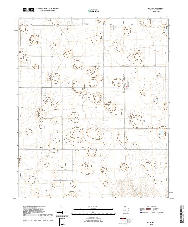
2022 Map of New Home
USGS Topo · Published 2022About this map
New Home sits at the intersection of FM 211 and FM 1730, serving as the primary hub for this agricultural portion of Lynn County. The map reveals a strictly organized grid of county roads, such as Co RD 6 and Co RD 11, which divide the landscape into large rectangular tracts characteristic of the Texas South Plains. To the southwest, the small settlement of Petty marks another historic point of local navigation along FM 1328. The terrain is defined by numerous small depressions and play basins, which are common features in this cotton-producing region. Modern residential development is visible on the northern edge of New Home along streets like Kitty Hawk Ln and Hiracheta Dr, reflecting the slow expansion of the community within its traditional rural framework.
Find a feature on this map
29 named features on this map. Tap any name to fly to it.
Don’t see what you’re looking for? This feature index may not catch every label — zoom into the map to look around manually.
Map Details
Editions of this 2022 New Home Map
This is the sole edition of this map. No revisions or reprints were ever made.
Other maps of this area

1954 · Lubbock
USGS Topo · 1:250,000

1954 · Brownfield
USGS Topo · 1:250,000

1957 · New Home
USGS Topo · 1:62,500

1957 · Meadow
USGS Topo · 1:62,500

1958 · Brownfield
USGS Topo · 1:250,000

1962 · Brownfield
USGS Topo · 1:250,000

1969 · Mound Lake
USGS Topo · 1:24,000

1969 · Tahoka
USGS Topo · 1:24,000

1969 · Double Lakes
USGS Topo · 1:24,000

1976 · New Home NW
USGS Topo · 1:24,000