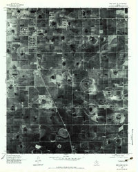
1976 Map of New Home NE
USGS Topo · Published 1983About this map
Agricultural patterns and the distinct playa lakes of the Texas South Plains define this 1976 orthophotoquad. The landscape is dominated by a grid of farm roads and large, circular irrigation patterns that surround the small settlements of Woodrow and Union. Unlike standard topographic maps, this rectified aerial imagery provides a clear view of the land use and farmstead placements at the height of the 1970s, showing the specific layout of fields and structures as they existed in the Lubbock area. The orthophoto format allows for the direct observation of the geological depressions common to this region, which appear as dark, irregular circles scattered across the cultivated plains.
Find a feature on this map
2 named features on this map. Tap any name to fly to it.
Don’t see what you’re looking for? This feature index may not catch every label — zoom into the map to look around manually.
Map Details
Editions of this 1976 New Home NE Map
2 editions found
Other maps of this area

1954 · Lubbock
USGS Topo · 1:250,000

1957 · Lubbock East
USGS Topo · 1:24,000

1957 · New Home
USGS Topo · 1:62,500

1957 · Lubbock West
USGS Topo · 1:24,000

1957 · Lubbock
USGS Topo · 1:62,500

1965 · Slaton
USGS Topo · 1:24,000

1965 · Buffalo Springs Lake
USGS Topo · 1:24,000

1965 · Wilson
USGS Topo · 1:24,000

1976 · New Home NW
USGS Topo · 1:24,000

1976 · New Home NE
USGS Topo · 1:24,000