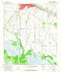
1963 Map of New Iberia South
USGS Topo · Published 1964About this map
Bayou Teche winds through the heart of this Acadiana landscape, anchoring a series of historic riverside settlements including Berard, Gajan, and Olivier. The map documents the mid-century transition of New Iberia, showing the southern extent of the city and its industrial connectivity via the Southern Pacific railroad. Away from the town center, the landscape is defined by the legacy of agricultural estates like Duboin Plantation and Little Valley Plantation, along with specialized infrastructure such as the Port of New Iberia and the New Iberia Southern Drainage Canal. Family-named coulees and bayous, including Peebles Coulee and Jacks Coulee, drain the low-lying terrain toward the marshy southern reaches. Local social life is preserved through the location of rural institutions like St Joseph Ch, St Thomas Ch, and Peebles Sch, alongside an Old Railroad Grade that hints at earlier transportation networks.
Find a feature on this map
43 named features on this map. Tap any name to fly to it.
Don’t see what you’re looking for? This feature index may not catch every label — zoom into the map to look around manually.
Map Details
Editions of this 1963 New Iberia South Map
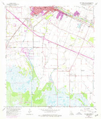
2 editions found
Other maps of this area

1937 · Jeanerette
USGS Topo · 1:62,500

1937 · Derouen
USGS Topo · 1:62,500

1939 · St. Martinsville
USGS Topo · 1:62,500

1941 · Loreauville
USGS Topo · 1:62,500

1945 · New Orleans
USGS Topo · 1:250,000

1954 · Loreauville
USGS Topo · 1:62,500

1954 · Jeanerette
USGS Topo · 1:62,500

1954 · Baton Rouge
USGS Topo · 1:250,000

1956 · Baton Rouge
USGS Topo · 1:250,000

1957 · St. Martinville
USGS Topo · 1:62,500