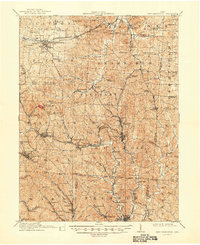
1911 Map of New Lexington
USGS Topo · Published 1948About this map
New Lexington serves as the focal point of this 1907-1908 survey, revealing a dense network of early 20th-century industry and settlement in the coal-rich hills of Perry County. The landscape is heavily influenced by competing rail lines, including the Cincinnati and Muskingum Valley RR and the Zanesville and Western Ry, which connected mines and small communities like Shawnee and Corning. Notable social institutions of the era are clearly marked, such as the St Aloysius Academy and the County Infirmary near Rehoboth.
Find a feature on this map
115 named features on this map. Tap any name to fly to it.
Don’t see what you’re looking for? This feature index may not catch every label — zoom into the map to look around manually.
Map Details
Editions of this 1911 New Lexington Map
2 editions found

Other maps of this area

1903 · Athens
USGS Topo · 1:62,500

1904 · Zaleski
USGS Topo · 1:62,500

1904 · Chesterhill
USGS Topo · 1:62,500

1905 · Athens
USGS Topo · 1:62,500

1906 · Chesterhill
USGS Topo · 1:62,500

1907 · Zaleski
USGS Topo · 1:62,500

1907 · Logan
USGS Topo · 1:62,500

1909 · Thornville
USGS Topo · 1:62,500

1909 · Logan
USGS Topo · 1:62,500

1910 · Philo
USGS Topo · 1:62,500