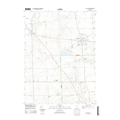
2013 Map of New London
USGS Topo · Published 2013About this map
New London serves as the primary hub of this North Central Ohio landscape, where the confluence of the Vermilion River and several of its tributaries, including the E Br Vermilion River, shapes the local drainage and topography. The village layout is densely gridded, featuring historical corridors such as W Main St and S Main St, while the surrounding rural areas are marked by a significant concentration of burial grounds that offer valuable data for genealogical research. These include the Grove Street Cem, Fitchville Cem, and the specialized Holy Cross Catholic Cem. Infrastructure is characterized by the intersection of major thoroughfares like Us-250 and Us-224, alongside distinctive local landmarks such as the New London Upground Reservoir and the private Mindzak Airfield. The map also captures smaller communities and named locales like Fitchville, Hereford, and the residential area of Woodlyn Acres.
Find a feature on this map
65 named features on this map. Tap any name to fly to it.
Don’t see what you’re looking for? This feature index may not catch every label — zoom into the map to look around manually.
Map Details
Editions of this 2013 New London Map
This is the sole edition of this map. No revisions or reprints were ever made.
Other maps of this area

1908 · Ashland
USGS Topo · 1:62,500

1908 · New London
USGS Topo · 1:62,500

1915 · Norwalk
USGS Topo · 1:62,500

1915 · Crestline
USGS Topo · 1:62,500

1943 · Crestline
USGS Topo · 1:62,500

1944 · Norwalk
USGS Topo · 1:62,500

1950 · Marion
USGS Topo · 1:250,000

1956 · Toledo
USGS Topo · 1:250,000

1960 · New London
USGS Topo · 1:24,000
1960 · Greenwich
USGS Topo · 1:24,000