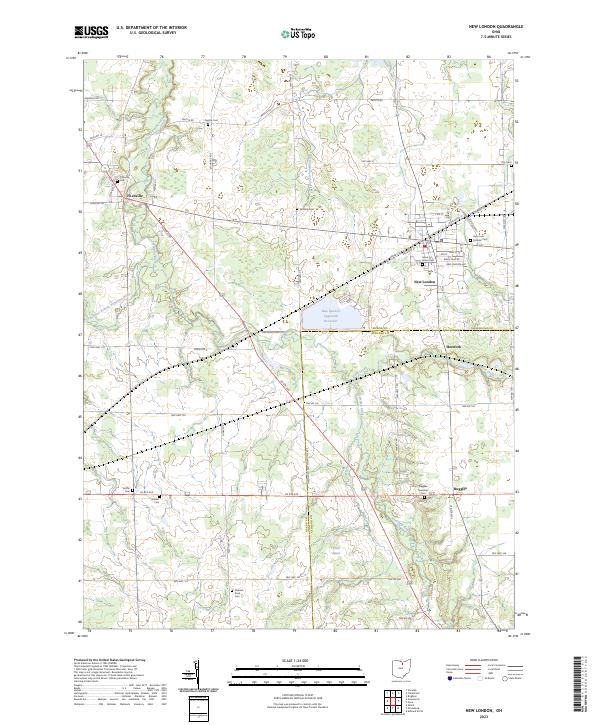
2023 Map of New London
USGS Topo · Published 2023About this map
The Vermilion River and its various tributaries, including the Southwest Branch Vermilion River, define the agricultural landscape of this corner of Ohio. The village of New London serves as the primary hub, where N Railroad St and US Rte 250 intersect. The area is dotted with small rural crossroads and settlements such as Fitchville, Herefork, and Ruggles, many of which maintain their own local burial grounds like the Fitchville Cem and Ruggles Township Cem. This modern survey reveals a community deeply rooted in its local history, with numerous cemeteries like the Quaker Cem and Ninevah Road Cem preserved across the township. The presence of the New London Upground Reservoir and Crall Pond highlights the importance of water management in this lowland terrain straddling the boundary between Huron Co and Ashland Co.
Find a feature on this map
63 named features on this map. Tap any name to fly to it.
Don’t see what you’re looking for? This feature index may not catch every label — zoom into the map to look around manually.
Map Details
Editions of this 2023 New London Map
This is the sole edition of this map. No revisions or reprints were ever made.
Other maps of this area

1908 · Ashland
USGS Topo · 1:62,500

1908 · New London
USGS Topo · 1:62,500

1915 · Norwalk
USGS Topo · 1:62,500

1915 · Crestline
USGS Topo · 1:62,500

1943 · Crestline
USGS Topo · 1:62,500

1944 · Norwalk
USGS Topo · 1:62,500

1950 · Marion
USGS Topo · 1:250,000

1956 · Toledo
USGS Topo · 1:250,000

1960 · New London
USGS Topo · 1:24,000
1960 · Greenwich
USGS Topo · 1:24,000